Home » Things to See and Do » Bike Routes Near Duncan, Arizona
Bike Routes Near Duncan, Arizona
Highway, Mountain/Gravel, and Long-Distance
We'll start this page with a big shout-out to Chester Hupp, inveterate road cyclist and keeper of a bike repair shop at his Duncan home shop. Chester has saved many a visitor's cycling trip, and the folks who enjoy his services rave about him. His business is Apex Cyclez: 928-965-1893.

Local Highway Riding
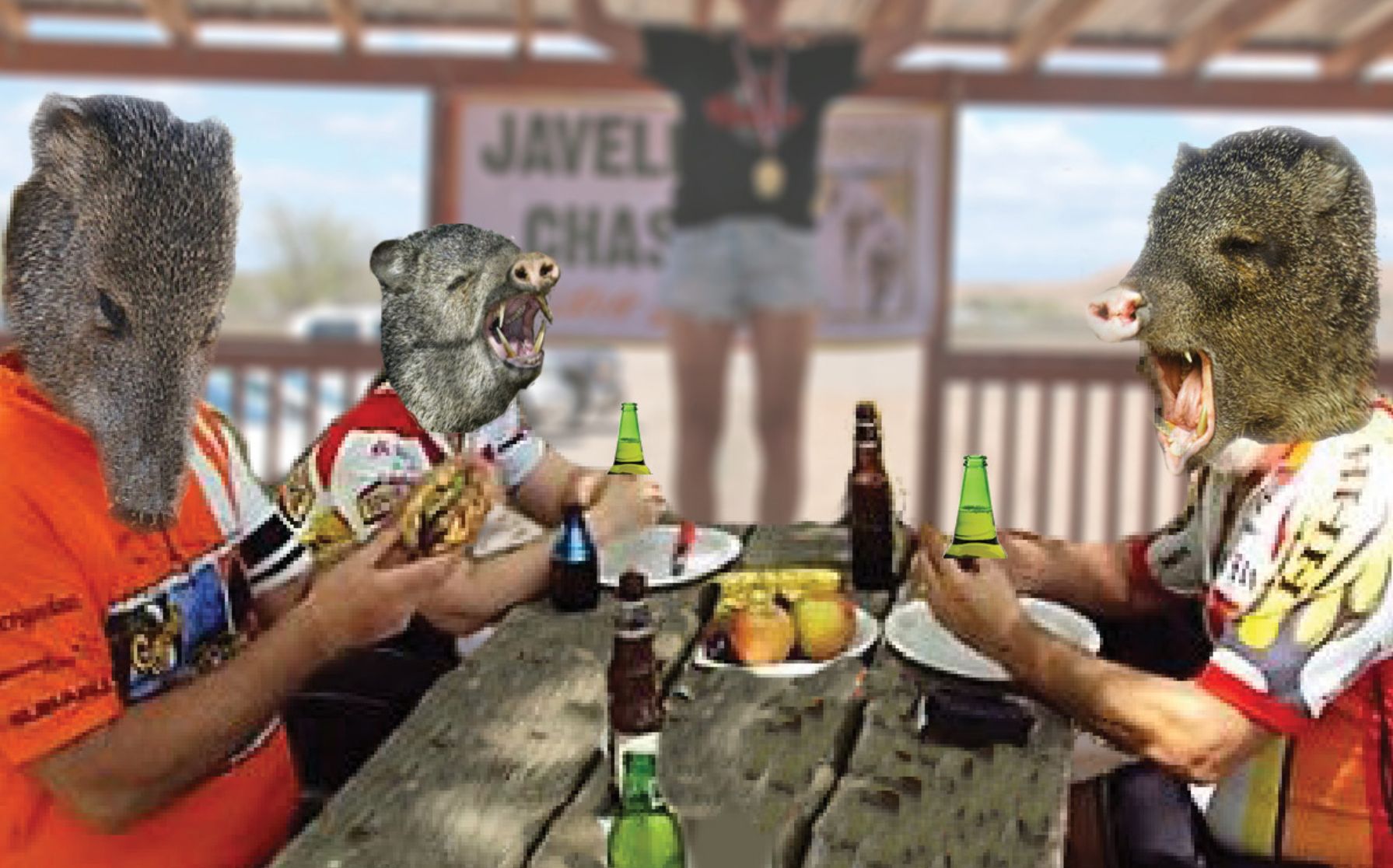
The Javelina Chase was an annual bike race event held in Duncan, Arizona, from 2015 through 2019. Riders and teams from across the Southwest participated. Set when the spring wildflower blooms stretched across the hillsides, the road races used Hwys. 70, 75, and 191 on the Arizona side, and Highway 92 in Virden, New Mexico. Cycling groups from Tucson and beyond continue to visit Duncan to train for other events. Bring your bike!
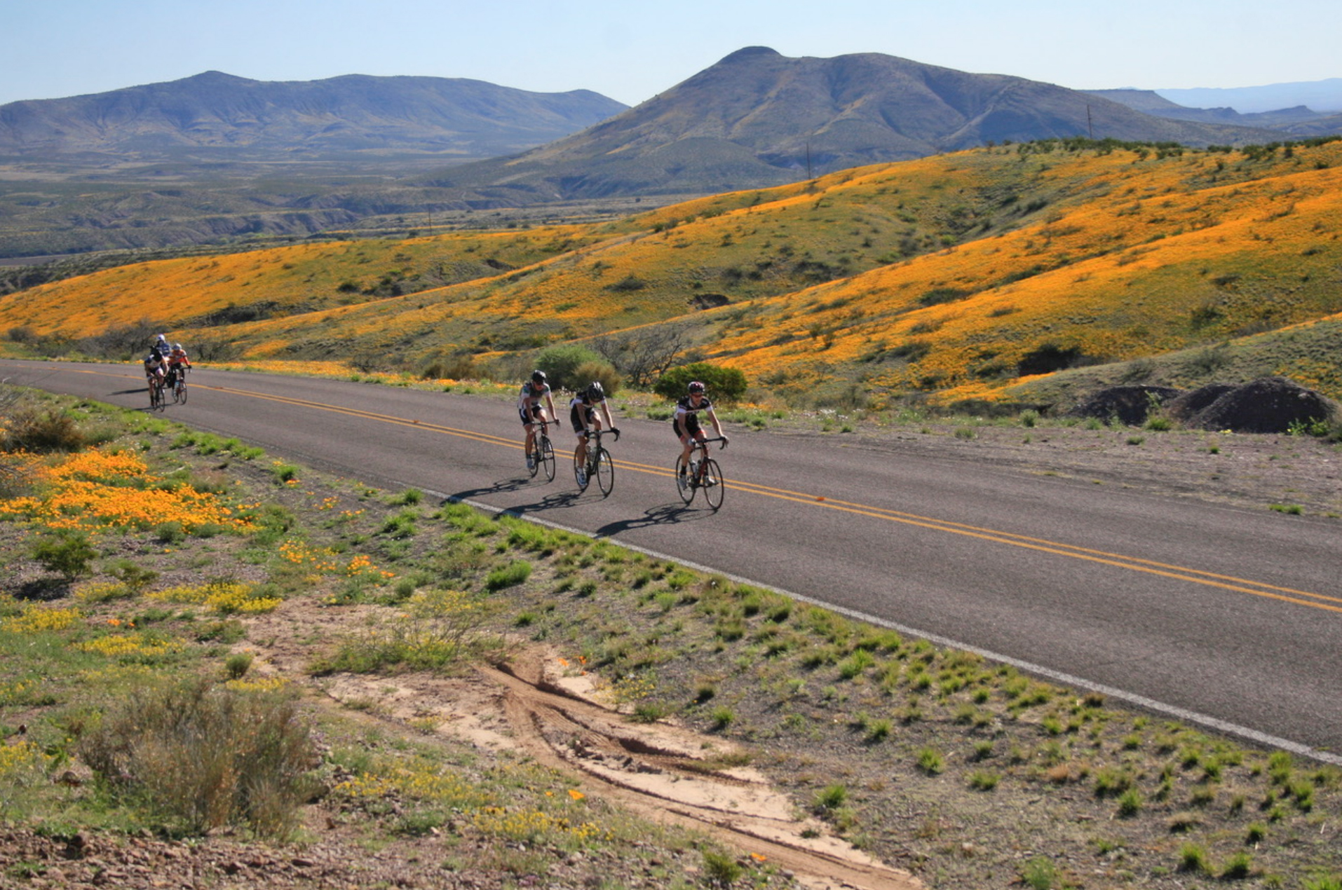
Photo by Norman Adams
The Ghost Mine Rumble Loop and More
The Ghost Mine Rumble was the mountain bike event of the Javelina Chase, a series of bike races held in Duncan, Arizona, from 2015 through 2019. The routes laid out for the mountain bike race are open to the public and take you through some of the most wildly beautiful and challenging terrain in southeastern Arizona and southwestern New Mexico. The trails climb quickly from the Gila River Valley into the stony peaks of the Summit Mountains. The rambling mountain road follows the old route to Silver City — and possibly the route of the 1540 Coronado Expedition — passing the sites of historic Apache-settler battles and ruins of mining towns and camps. Mountain bikes are strongly advised!
 Some visitors have enjoyed taking their gravel bikes on the county-maintained dirt roads of the Lazy B Ranch, where Supreme Court Justice Sandra Day O’Connor grew up. The ranch is also famous for the Round Mountain fire agate field that’s on the BLM grazing lease there (public lands). Just a little further out Highway 70 in New Mexico, on the north side of the highway, you can bike on Fuller Road (NM A027) to the Wilderness Study Area of the Lower Gila River Box Canyon of New Mexico. Pack a lunch!
The Southern Route from Lordsburg, New Mexico, to El Paso, Texas
Note: This narrative runs from west to east.
We've gathered this information over the last dozen years from cyclists who have taken this route. All of those who reported back to us reported favorably. There is one long day involved, from Columbus, New Mexico, to the outskirts of El Paso, which we have shortened (to 63 miles) by making the end point an inexpensive Travelodge in Santa Teresa, New Mexico. Those who want to cycle a few more miles can go on into El Paso.
We learned of this route from cyclists who searched it out in order to avoid the steep climb from Lordsburg to Silver City. It is also the best way to avoid icy conditions on the Emory Pass east of Silver City, which can continue into the spring. Adventure Cycling has not yet included this route in their maps. Be sure to let them know if you ride it and think that they should pay attention. It took three years of lobbying — by us and many cyclists — to get our town of Duncan included on their route map. We would like to see them add this southern route between us and El Paso.
A shout-out goes to Jeff Sharp, whose facilities in the tiny town of Hachita, New Mexico, have made this route a reasonable option for cyclists. Jeff also contributed valuable info and insights to this article. He can be reached at (575)-519-9111 or sharpjeffery1@gmail.com.
Except for the first ten miles on I-10, this route is all rural two-lane blacktop until you get to Santa Teresa. There are no shoulders, but traffic is very light and you will always have plenty of time to sidle out of the way when a vehicle approaches. Except for the tiny towns of Hachita and Columbus, this is all ranch and farm country. You'll see the locals in their vehicles, and you'll see Border Patrol, but very little through-traffic. Elevations range from about 4200 to 4900.
We have traveled these highways over and over by car. The route is exceptionally lovely and quiet. The remoteness means that you must get your supplies without fail when you are in the towns. There are a few ranch houses visible from the highways, but none of them has surfaced yet as a resource for cyclists.
Day One – Lordsburg to Hachita
If your point of origination is the far east side of Lordsburg, where there are two big gas station/travel centers and a Denny's, this is a 46-mile day. You do have to get on I-10 East for about ten miles. But once you get off the interstate at NM 113, it's glorious. (Alternatively, you can stay on I-10 another 15 miles to NM 146, to Hachita.)
This is rangeland, cattle country. It's a leisurely, quiet route despite its initial proximity to the interstate. Deer and antelope roam there. You'll spot lots of winged wildlife (check out the ebird.org lists for Hachita. A little more than halfway down 113, you'll see a kiosk for the Continental Divide Trail, which crosses the highway there on its way between the Mexico border and Lordsburg. Don't be surprised if you see hikers.
Hwy. 113 runs 20 miles to end at NM Rte. 9. As you approach the intersection, you'll be looking at the ragged and forbidding slopes of the Big Hatchet Mountains and, to the west of them, the Little Hatchet Mountains.
When you reach that intersection, Playas will be to the west. Don't bother going there. It is a counter-terrorism training center run by New Mexico Tech, serving branches of the U.S. military. Visitors are not welcome.
Instead, turn east toward Hachita. You have another 15 miles to go before you reach the Hachita Food Mart, which is open every day from 6 am to 10 pm. It's a tiny rural market, but you can get basic supplies there, and they have enough foodstuffs to keep you going.
You have two options for shelter in Hachita.
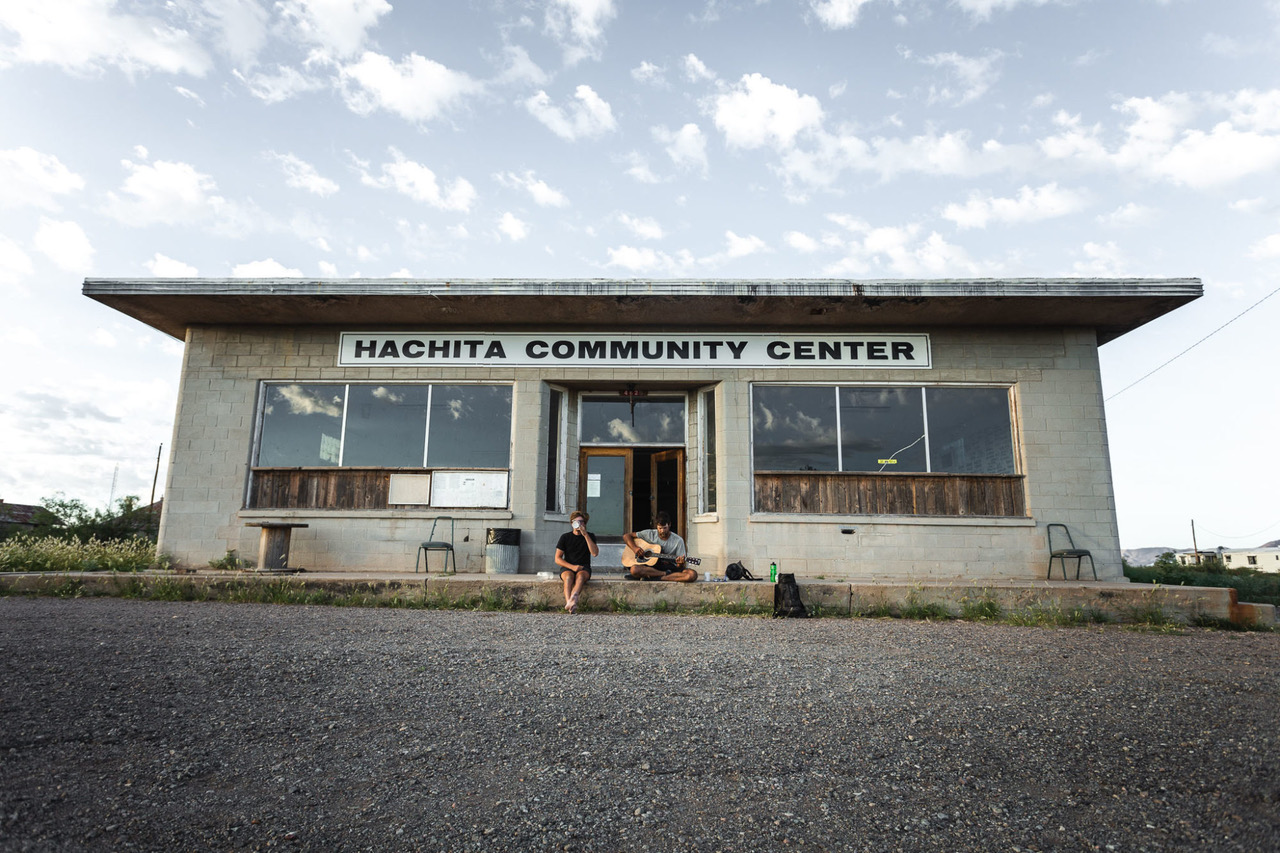
Photo from www.backpacking.com
The deluxe option is one mile west of Hachita on Rte. 9, at mile marker 43, north side. Jeff Sharp created the “Bike Ranch” as an indoor camping spot for both long-distance cyclists and hikers on the Continental Divide Trail. Jeff is a mountain biker who also assists hikers on the CDT, picking them up at the Tucson airport and shuttling them to the trailhead on the Mexico border south of Hachita. Because there are no restaurants in Hachita, he also feeds guests at the Bike Ranch. His rates are reasonable. You can book a place to spread your sleeping bag either in the main house or a private "bunkhouse" on the property (where you don't have to sleep on the floor). Jeff also has some bike tools and various supplies. Be sure to contact him in advance, as he is not always in town. (575) 519-9111, sharpjeffery1@gmail.com.
The other option is indoor camping at the Hachita Community Center. Jeff Sharp gave us the following advice about that to pass along to cyclists: "When you get to Hachita, inquire at the Food Mart about camping at the community center. Or ride on to the community center, and see if Dan is home in the house with a picket fence behind it."
Either way, it's a good idea to make your arrangements well in advance. Be sure to ride or walk around and see the abandoned Catholic church and school a little bit south of the highway on Antelope Wells Road.
When we first started sending cyclists this way about 12 years ago, there was no Bike Ranch and no Food Mart. There was a friendly postmaster who kept bottled water in the fridge for cyclists, and would allow women (not men) to use the post office toilet. We heard that she also invited women traveling solo to camp in her yard. Right around the time she retired and fell off the cycling map, Jeff Sharp came across our screen. His presence in Hachita has made this route considerably more hospitable for long-distance cyclists.
Day Two - Hachita to Columbus
It's 43 miles from the Hachita Community Center to the center of Columbus. Heading out, you will soon cross the Continental Divide Trail again. South of Hwy. 9, on the eastern slopes of the Big Hatchets, the New Mexico “bootheel” cuts north. As you ride east, you'll start to catch glimpses of the border wall. Mexico will remain in sight through much of your remaining miles in New Mexico and Texas.
On this stretch, you'll also see more farming and less ranching. With every rain, the mountain slopes recharge the aquifers that lie under the massive valley. You'll see playas – wide stretches of water or barren sand – because this land drains to no river but holds its water, whether visible or not. The farms you pass are pumping from these unseen natural storage vaults. If you wonder whether they are living on borrowed time, you would not be wrong.
As you ride into Columbus, you'll see Pancho Villa State Park on the south side of the highway. This is a comfortable place to camp, and an easy walk to the town's restaurants. If you want to pay for a room, we have liked staying at Hacienda de Villa, just around the corner on Hwy. 11. Proprietor Martha has made the very affordable rooms welcoming and homey. There is also a B&B-type lodging in town called Los Milagros that is warmly accommodating to cyclists.
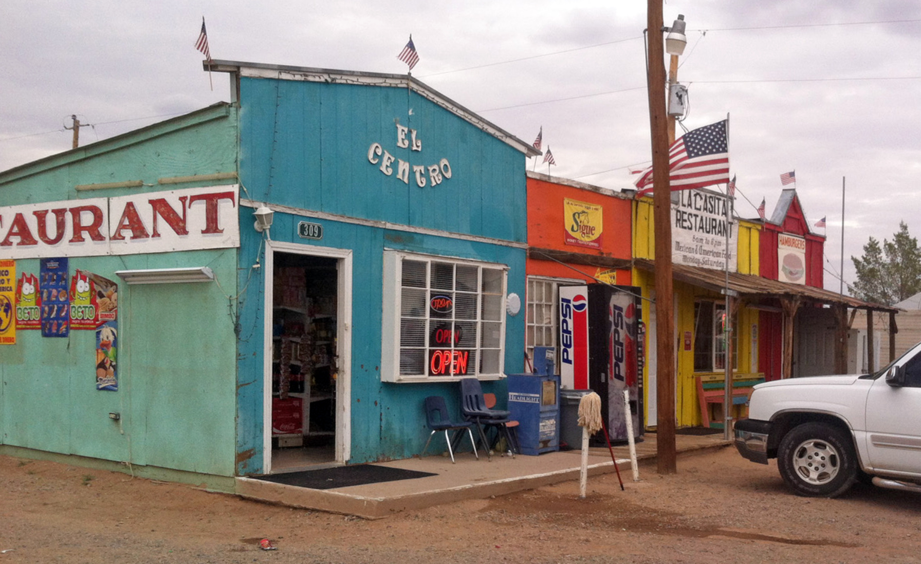
Columbus, New Mexico (2015)
Our favorite restaurant in Columbus is the Borderland Grill. But there are several other good options. See what is open on the day of your visit.
Another enticement of Columbus is its unusual history, the chief highlight of which was a deadly raid by Pancho Villa's horsemen in 1916. The small historical museum on the train tracks at the intersection of Hwy. 9 and Hwy. 11 is worth your time.
You can stock up on provisions at either the locally owned San Jose Grocery in Columbus or the Family Dollar just north of the Port of Entry. A note from one cyclist's experience: everything in Columbus is closed on Christmas Day, and Thanksgiving Day is probably the same. So plan accordingly! We had one guest who was unable even to find a room on Christmas Day. But Martha at the Hacienda de Villa did some quick thinking and figured out how to get him squeezed in for the night between other guests.
Columbus is just two-and-a-half miles from the colorful Chihuahuan border town of Palomas. As long as you have a valid driver's license you can cross back into the US. Don't be put off by the buy-something overwhelm of the famous Pink Store. The food is excellent there. And you can ask Jeff Sharp about a bunkhouse over the border in Palomas, for your overnight.
We have noticed that the majority of distance cyclists are on a schedule and don't plan to linger even for a few hours in any of the places where they pass a night. Sometimes a mechanical issue or illness or rain or particularly unpleasant headwinds will lead to an unplanned pause. We're always happy to accommodate when that happens to someone who is with us, and those folks generally seem to be relieved too that fate landed them in Duncan, of all places. Please note that Columbus would be another good choice of place to slow down or stop for a bit. It is thoroughly charming and – except perhaps for mechanical services – has pretty much everything you might need.
Day Three – Columbus to El Paso (or at least to Santa Teresa)
The Pink Store in Palomas, Chihuahua
This is the long day with no services. Make sure that you have enough water. There will be more traffic than on the earlier segments, but not enough to spoil the sense of leisure. Do watch out for the occasional extra-wide load with farming or mining equipment.
We see that the first hotel you will encounter as you enter Santa Teresa (just northwest of El Paso) is an inexpensive Travelodge by Wyndham. It's right by a Love's truck stop. Booking there will guarantee you a 63-mile day. But you may feel hale and hearty enough to go on into downtown El Paso, where there are multiple options.
To ride on into El Paso, Jeff Sharp shared the following advice: Take Airport Road down to McNutt Road and ride that all the way down to the river (the Rio Grande) along the El Camino Trail into downtown El Paso. This route avoids the hill climb up Mesa Blvd. The Gardner Hotel & Hostel is downtown (https://www.gardnerhotel.com). Jeff says it is a favorite among distance cyclists. There is also a very popular bike shop/coffee house combo.
And this is where we leave you in the capable hands of Adventure Cycling. Ride on!